


Description:
CHARACTERISTICS OF THE TOWN OF BUJ
The area of the town of Buje is located in the northwestern part of the Istrian peninsula and the Republic of Croatia. Approximately 5,300 inhabitants live in the area of 103.40 km2. The town of Buje is located between the rivers Mirna and Dragonja. In the north are the hills of the Upper Buje region, and in the south the Adriatic Sea in Kanegra and the Piran Bay, ie Savudrija Bay.
Together with Umag, Novigrad, Oprtalj, Brtonigla and Grožnjan, as well as numerous other places and settlements, the town of Buje forms the Buje region.
The landscape is diverse and rich. The wide belt in the north geologists call the Buje karst or the saddle (anticline) plateau Buje. There are frequent depressions or valleys, covered with red earth, mixed in places with clayey deposits.
Towards the Mirna valley, the terrain descends slightly towards a plain that slopes to the sea.
The landscape here is enriched by stepped terraces planted with vines and olive trees.
Proximity to the sea and continental landscape, diversity of Mediterranean and mild continental climate, tradition in agricultural production, crafts, industry, hunting and tourism, valleys and hills, untouched nature, absence of environmental pollutants, proximity to Pula, Rijeka, Koper and Trieste make the area of Buje attractive area of the Istrian peninsula.
The city of Buje is the administrative, judicial and school center of the Buje region.
In Buje are located:
municipal court with land register and cadastre,
primary and secondary schools in Croatian and Italian language of instruction,
county offices,
Honorary Consulate of the Republic of Italy,
customs office and police station.
Due to its strategic position, the City of Buje is a significant traffic hub of international character.
The highest order has the road direction Pula – Koper-Trieste, now the main road. The connecting route is important both for connecting the two neighboring republics and for connecting the Republic of Croatia with the transport network of Western Europe and vice versa. The route of the Istrian Y passes through the area of the city.
The first railway station is in Buzet on the Croatian side and in Koper on the Slovenian side. Nearby are the airports: “Portorož” (Sečovlje, Slovenia), “Ronchi dei leghionari” (Trieste, Italy) and Pula Airport.
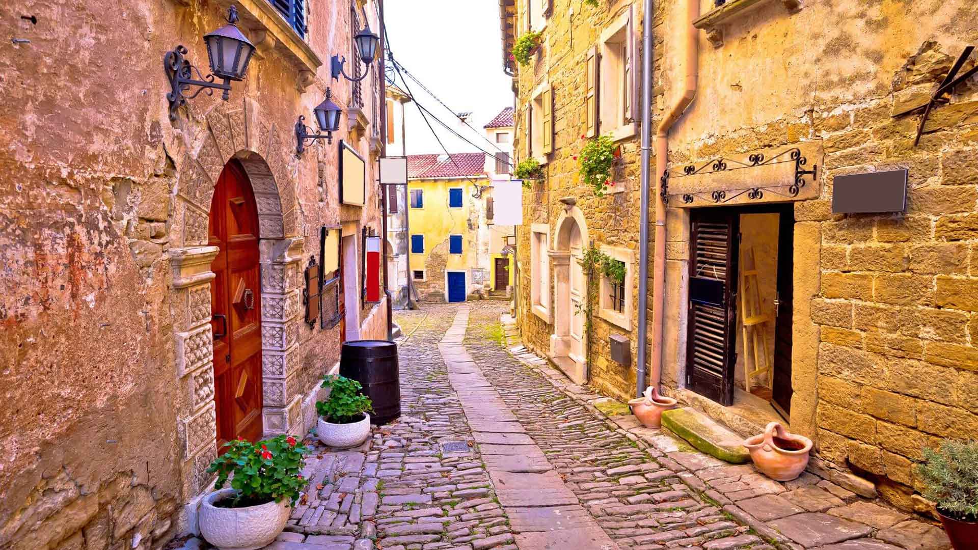
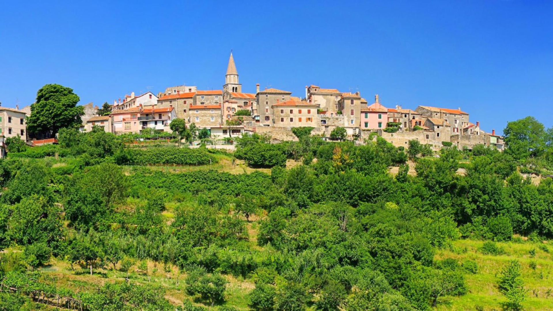
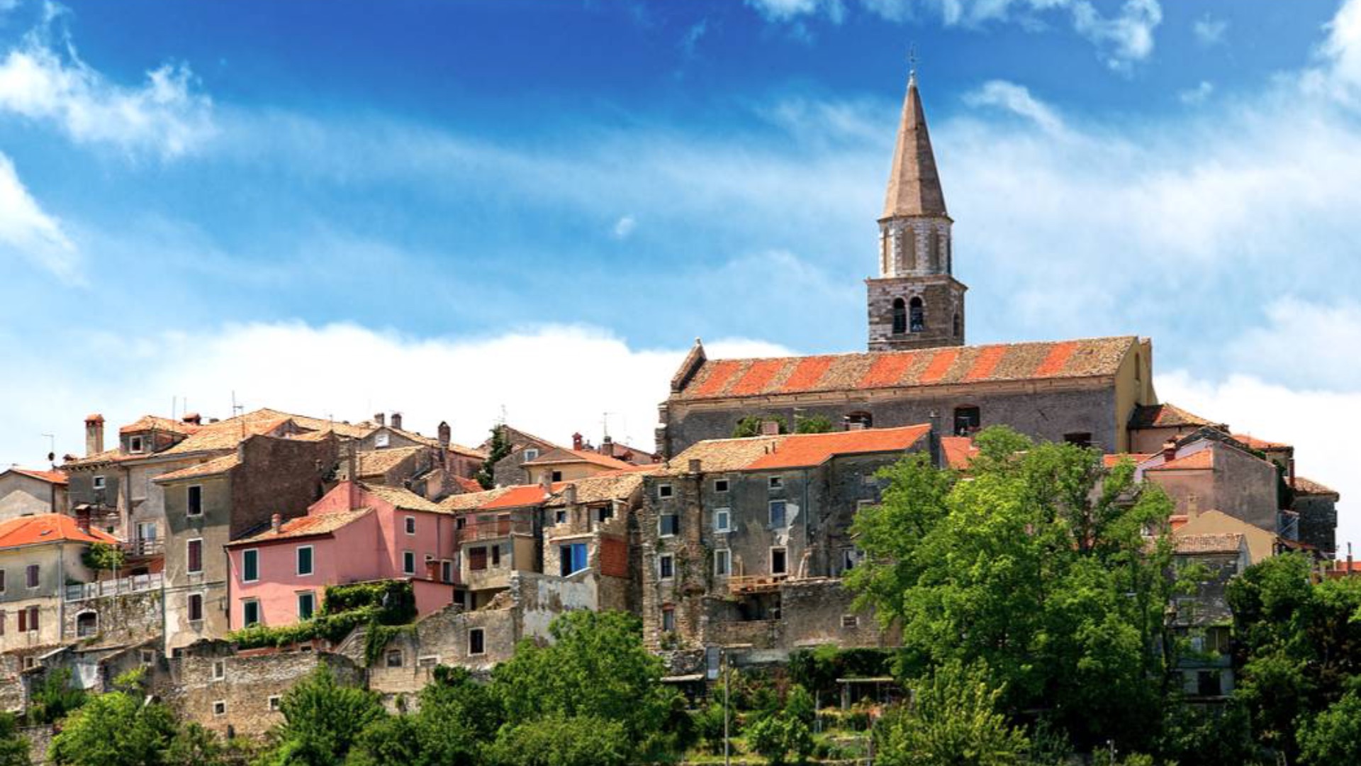
The settlement of Buje itself is located on the top of a hill whose image appears in history as a concept of the Istrian landscape – limited forms well adapted to the terrain, views and silhouettes that respect the scale of the environment.
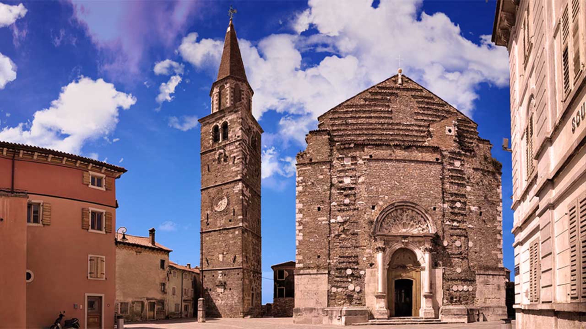
The parish church is located on the upper square and, along with other buildings from different periods, testifies to the historical and cultural heritage of Buje. From the central area, paved streets lead to the contrada and to the lower square, from where the view extends to the sea. From the end of XVIII. century the settlement expanded beyond the defensive walls and created new neighborhoods that are today commercial, administrative, cultural, school and sports centers.
The city area stretches over several hills. It is divided into several parts, which are connected by side or main roads.
Parts of the city are:
Sv. Sebastian – the westernmost part and one of the youngest built parts of the city,
Brolo – is located between the Old Town and Sv. Sebastian,
Old town – the historical center of the city,
New part of the city – a newly built part that forms the judicial, administrative and political center of the city,
Rudine – apartment block built in the seventies and eighties,
Školski brijeg – the center of education where all school institutions, sports hall and health center are located,
Monte Bašter – the easternmost part of the city near which the city cemetery is located,
Station – built near the old Austro-Hungarian railway station, which soon became the economic center of Buje.
Apart from Buje, the area also includes the larger settlements of Kaštel, Plovanija, Momjan, Marušiće, Krasica and Kršete.
Interesting facts and links about the city of Buje

Where are they?

Villa Maze
Description: Villas Maze are new modern and sleek villas located in the center of Novalja. Exclusively furnished and fully equipped…

Motodrom Poreč
Description: Our rental trail was built in 1999 according to international standards and today is one of the best outdoor…

Hotel Vilola
Description: Vilola is a high category family away from just a hundred meters from the sea, along the main road…

Holiday House Stancija Marusi
Description: Surrounded by green nature and peaceful countryside, the Holiday House Stancija Marusi offers comfortable accommodation close to the beautiful…

Winery Cattunar
Description: Wine Residence Cattunar is a peaceful oasis placed in the middle of the most active part of Istria The…

Ski Lift Poreč
Description: The Poreč ski lift is a 650 m long water lift in Zelena Laguna. At the Poreč ski lift…

Contact
Grad Buje
Istarska 2
52460 Buje
Hrvatska • CRO
+385 52 772 128
Working Hours
---


From Same Category
Other Categories
Order Card

Ski Lift Poreč
Description: The Poreč ski lift is a 650 m long water lift in Zelena Laguna. At the Poreč ski lift…

My Old Lady
My Old Lady Description: The dream of a boat – on land! If you want to enjoy your drink in…

Roxanich
Description: Roxanich Wine & Heritage Hotel is a modern building that will add the necessary note of luxury, style and…

Villa Tišina
Description: This stylishly renovated stone house is located in the middle of vineyards and olive groves – built in 1848!…
Hotel Vilola
Description: Vilola is a high category family away from just a hundred meters from the sea, along the main road…

Marittimo – Zum Steirer
Marittimo – Zum Steirer Description: “Zum Steirer” opened its doors in 2021 and more than lives up to its name.…